




Image Courtesy: NASA/ Wikipedia/ Public Domain
For decades, Antarctica has remained one of the Earth’s greatest geological mysteries, with more than 99 percent of its bedrock concealed beneath an ice sheet several kilometres thick. Now, scientists have uncovered one of the continent’s most remarkable hidden features—a colossal fan-shaped geological structure buried deep beneath the East Antarctic Ice Sheet that could reshape our understanding of Antarctica’s ancient past and improve predictions about its future in a warming world.
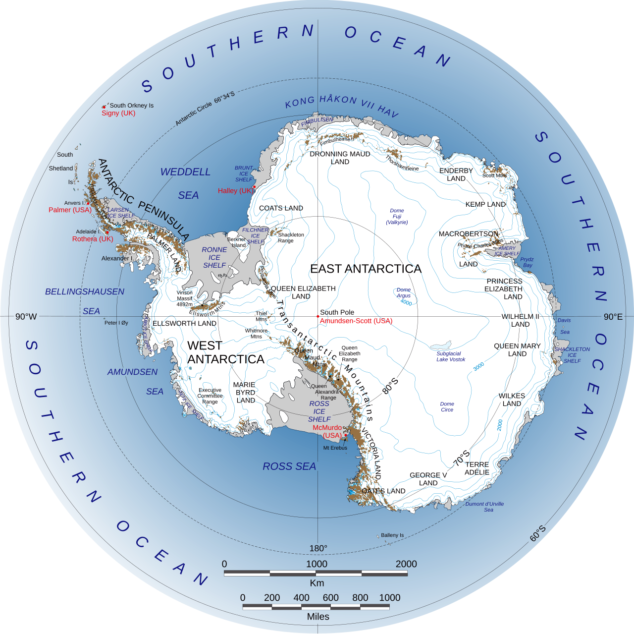
The newly discovered formation, named the East Antarctic Fan-shaped Basin Province (EAFBP), is not a single basin but a vast network of interconnected subglacial basins stretching across a significant portion of East Antarctica. Researchers found that several well-known geological features—including the Wilkes Basin, Aurora Basin and the basin that contains Lake Vostok, the world’s largest known subglacial lake are actually components of one enormous geological system rather than isolated structures.
The discovery was led by Dr Egidio Armadillo of the University of Genoa, with contributions from an international team of scientists.
What makes the discovery particularly significant is the way the structure appears to have formed. Scientists believe it originated through a process known as distributed rotational extension, in which the Earth’s continental crust stretches outward from a fixed central point. The researchers compare the pattern to an opening hand or a handheld fan—the central point remains relatively stable while the surrounding crust spreads apart, creating large triangular basins between the ‘fingers’. According to the team, this may represent one of the largest examples of rotational extension ever identified within continental crust.
The formation likely dates back hundreds of millions of years, when Antarctica was part of the ancient supercontinent Gondwana, alongside India, Australia, Africa and South America. As Gondwana gradually fragmented, immense tectonic forces stretched and fractured the continental crust. Scientists believe the newly identified basin province may preserve one of the largest geological fingerprints of that breakup and may even have played a role in the eventual separation of Antarctica and Australia around 70 million years ago.
To uncover this hidden landscape, researchers combined multiple datasets, including radar-derived subglacial topography, gravity measurements, magnetic surveys, seismic information and models of the Earth’s crust and lithosphere. An important part of the research involved reconstructing what East Antarctica would look like if its massive ice sheet were removed. This ‘rebounded topography’ accounted for the upward movement of land once relieved of the enormous weight of the ice, allowing scientists to better identify the orientation and shape of the buried geological structure.
Beyond revealing Antarctica’s geological history, the discovery has major implications for climate science. The shape of the bedrock beneath the ice strongly influences how glaciers and ice streams move. Hidden valleys and basins guide the flow of ice, determine where subglacial lakes form and affect the stability of regions that are especially vulnerable to climate change.
The findings also challenge the long-held assumption that East Antarctica is a largely stable and inactive geological region. Instead, the newly identified basin province suggests the continent experienced far more dynamic tectonic activity than previously believed. Researchers say the formation may even have influenced other major hidden features, including the buried Gamburtsev Mountains and parts of the Transantarctic Mountains. The discovery raises as many questions as it answers. Scientists still do not know precisely when the structure formed or what geodynamic processes drove its evolution. With most of Antarctica’s bedrock hidden beneath kilometres of ice, researchers believe many more geological surprises remain undiscovered beneath the frozen continent.