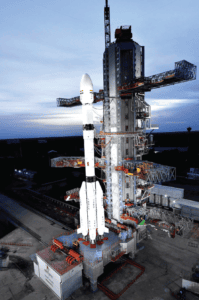




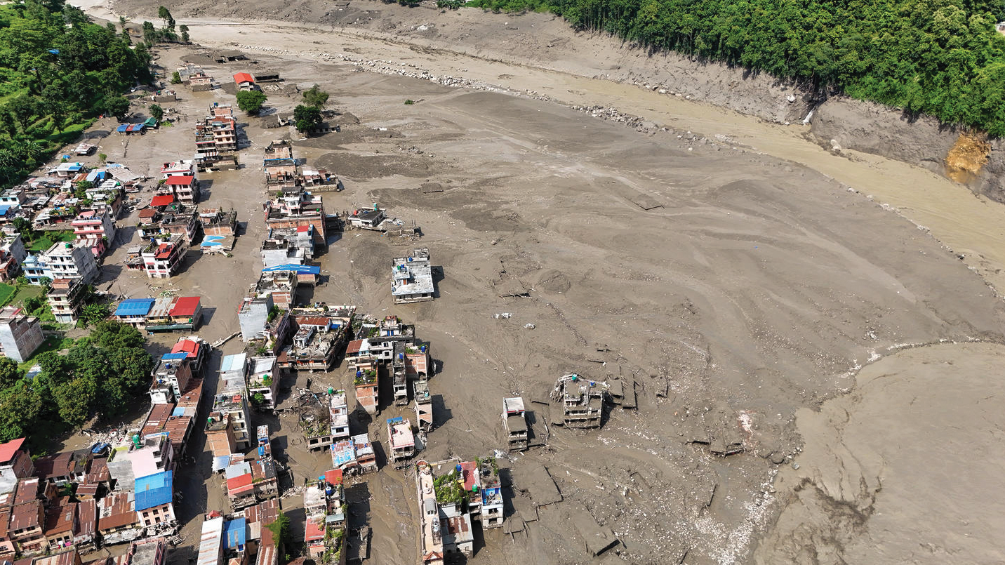
Image Courtesy: Screengrab from a video circulating on social media
Every disaster begins long before it becomes visible. Today, satellites orbiting hundreds of kilometres above Earth, sensors hidden beneath rivers and mountains, and powerful computer models are helping India anticipate hazards before they strike. Science is no longer merely explaining disasters—it is helping prevent them, protecting lives and enabling the nation to build a safer and more resilient future.
WHEN EVERY MINUTE COUNTS
What comes to your mind when you hear the word disaster?
Perhaps it is images of rescue workers searching through collapsed buildings, flooded streets after relentless rain or families taking shelter as a cyclone approaches the coast. These scenes dominate television and social media because they capture the dramatic aftermath of nature’s fury. Yet the real story of disaster management begins much earlier—often days before the disaster itself.
The first responder is not always a firefighter, a doctor or a rescue worker.
It is science.
Long before a cyclone makes landfall, a river overflows or a mountain slope collapses, an invisible scientific network is already at work. Earth observation satellites scan clouds, oceans and landscapes from space. Doppler Weather Radars monitor the growth and movement of storms. River gauges measure rising water levels, ocean buoys record changing sea conditions, while seismic stations detect tiny vibrations beneath the Earth’s surface. Every second, millions of observations are analysed using sophisticated computer models that transform raw data into reliable forecasts.
The most valuable outcome of this scientific effort is not information alone—it is time. Time to warn fishermen to return safely to shore. Time to evacuate vulnerable communities. Time for hospitals to prepare for emergencies and disaster response teams to move into position. In disaster management, even a few extra hours of warning can save thousands of lives.
India’s remarkable geographical diversity also makes it one of the world’s most hazard-prone countries. The Himalayas face earthquakes, landslides and glacial hazards. The Ganga and Brahmaputra river systems experience recurrent floods. Cyclones threaten both the eastern and western coasts, while droughts, heatwaves, lightning and forest fires affect many regions. Climate change, rapid urbanisation and expanding infrastructure in hazard-prone areas are making these risks more complex and more severe.
The Indian Ocean tsunami of 2004 marked a turning point in India’s disaster management journey. It exposed major gaps in preparedness but also inspired unprecedented investments in weather forecasting, ocean observation, satellite technology and scientific monitoring. Over the past two decades, these investments have transformed India’s ability to anticipate hazards and reduce disaster risks. Accurate forecasts and timely warnings now enable governments and communities to act before hazards become disasters.
Modern disaster management therefore begins not with emergency response but with understanding risk. It is a journey from scientific observation to informed action—a journey that is saving lives every day.
UNDERSTANDING RISK: THE SCIENCE BEHIND DISASTERS
Why does the same cyclone devastate one place while another suffers only minor damage? Why does identical rainfall replenish water resources in one valley but trigger floods and landslides in another?
The answer lies in one of the most important ideas in disaster science: natural hazards do not automatically become disasters.
Consider two neighbouring valleys receiving the same intense rainfall. One is protected by forests, has healthy drainage and very few settlements. The other has expanding towns, roads carved into unstable slopes and houses built along riverbanks. Although the rainfall is identical, the consequences are very different. In the first valley, water is absorbed or flows away safely. In the second, rivers overflow, slopes fail and infrastructure is damaged. The difference is created not by nature alone but by the way people interact with their environment.
Scientists explain disaster risk through the interaction of three factors—hazard, exposure and vulnerability. A hazard is a potentially damaging event such as an earthquake or a cyclone. Exposure refers to the people, buildings and infrastructure located in harm’s way. Vulnerability reflects how susceptible they are to damage because of poor construction, environmental degradation, poverty or inadequate preparedness. Reducing any one of these factors lowers disaster risk.
Understanding these interactions requires continuous scientific observation. Across India, thousands of instruments monitor the atmosphere, rivers, oceans and the Earth’s crust. Automatic weather stations measure rainfall, temperature and wind. Doppler Weather Radars track severe storms. River gauges monitor changing water levels, ocean buoys observe sea conditions, while seismic networks continuously record earthquakes.
These observations are combined with advanced numerical models that forecast cyclones, heavy rainfall, floods, storm surges and heatwaves days in advance. Although earthquakes cannot yet be predicted, decades of geological research have enabled seismic hazard mapping and earthquake-resistant engineering that significantly reduce risk.
Earth observation satellites have revolutionised disaster management by providing rapid information on floods, landslides, forest fires, coastal erosion and damaged infrastructure. When integrated with Geographic Information Systems (GIS), topography, land-use information and population data, they generate detailed risk maps that guide safer development. Increasingly, Artificial Intelligence (AI) is analysing these enormous datasets, improving forecasts and helping decision-makers respond more quickly and effectively.
Disaster risk is therefore not static. Climate change, urbanisation and changing land use continuously reshape the risk landscape. Understanding these evolving risks is the first step towards reducing them and building resilient communities.
FROM KNOWLEDGE TO ACTION
A forecast by itself does not save lives. Decisions do.
No matter how accurate a scientific prediction is, it has little value if it remains on a computer screen. It must reach the right people at the right time and prompt the right actions. A cyclone warning should encourage fishermen to return to shore, district administrations to activate evacuation plans, hospitals to prepare for emergencies and families to move to safer locations. The real success of science lies not only in predicting hazards but in enabling people to act before danger arrives.
This transformation from scientific knowledge to public safety depends on strong institutions and effective governance. The Disaster Management Act, 2005 laid the foundation for a comprehensive national disaster management system. Guided by the National Disaster Management Authority (NDMA) and supported by national, state and district institutions, India’s approach has evolved from a relief-centric model to one that emphasises prevention, mitigation, preparedness, response and resilient recovery.
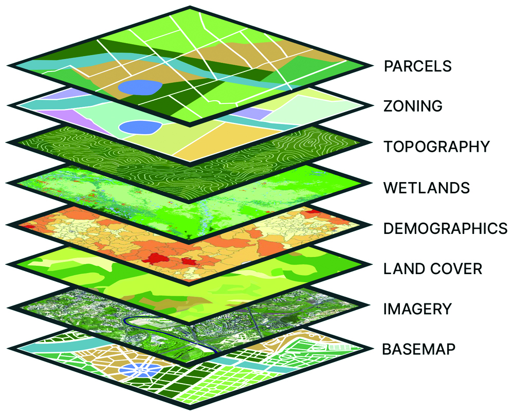
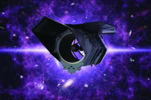
Image Courtesy: NASA
One of the most significant advances has been the shift from early warning to early action. Modern forecasting systems provide valuable lead time, but warnings save lives only when they are timely, trusted and understood. Today, alerts reach millions of citizens within minutes through mobile phones, television, radio and digital communication platforms. Increasingly, these are impact-based warnings that explain not only what hazard is expected, but also where it is likely to occur, its probable consequences and the actions people should take.
Scientific knowledge also influences development decisions long before disasters occur. Engineers and planners increasingly ask whether a proposed highway, bridge, hospital, airport or urban settlement will remain safe under future floods, earthquakes, cyclones or landslides. This approach, known as risk-informed development, integrates hazard assessments, engineering standards and climate projections into planning and design. Building resilience at the planning stage is far more effective—and far less expensive—than rebuilding after disaster strikes.
Communities are equally important partners in this process. School safety programmes, public awareness campaigns, mock drills and trained volunteers ensure that scientific information is translated into practical action. When people understand risks and know how to respond, they become the strongest link in the disaster management chain.
Science therefore achieves its greatest value when it informs policy, guides development and empowers communities. It transforms knowledge into action and action into resilience.
BUILDING RESILIENCE: PREPARING FOR TOMORROW
Can we stop an earthquake or prevent a cyclone from forming?
The answer is no. Natural hazards are part of the Earth’s dynamic systems and cannot be controlled. What we can control is how well we prepare for them. The objective of modern disaster management is not to prevent hazards but to prevent them from becoming human tragedies. This ability to anticipate, withstand, recover from and adapt to disasters is known as resilience.
Resilience begins with mitigation. Scientific studies identify flood-prone areas, earthquake hazard zones, unstable hill slopes and cyclone-vulnerable coastlines. Engineers use this knowledge to design safer buildings, bridges, dams and other critical infrastructure, while planners incorporate hazard assessments into land-use planning. Every investment in resilient infrastructure protects lives, reduces economic losses and supports sustainable development.
Nature itself provides some of the most effective protection against disasters. Mangrove forests weaken storm surges, wetlands absorb floodwaters and forests stabilise fragile slopes while improving water retention. These nature-based solutions not only conserve biodiversity but also strengthen resilience, demonstrating that environmental protection and disaster risk reduction go hand in hand.
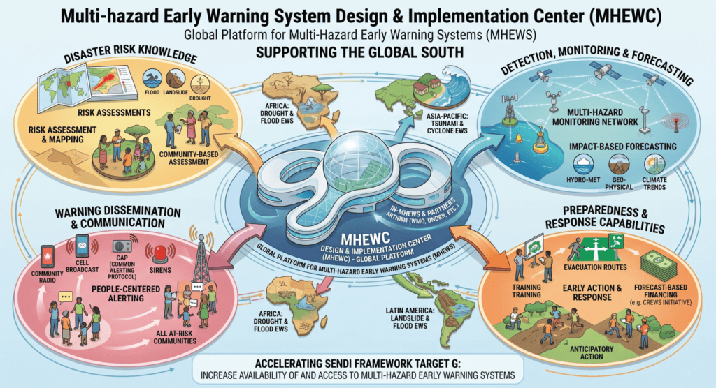
Preparedness ensures that scientific knowledge reaches people before disasters do. Community awareness programmes, school education and regular mock exercises help citizens understand risks and respond confidently during emergencies. India has significantly strengthened its Multi-Hazard Early Warning Systems (MHEWS) by integrating information from satellites, weather radars, river monitoring networks, ocean observations and seismic stations. These systems now provide increasingly accurate and location-specific warnings, enabling timely action by both authorities and communities.
When disasters do occur, technology supports rapid response. Drones, satellite imagery, Geographic Information Systems (GIS) and satellite communications improve situational awareness, accelerate damage assessment and help emergency responders direct relief where it is needed the most. Recovery is guided by the principle of ‘Build Back Better’, ensuring that reconstruction creates safer homes, stronger infrastructure and more resilient communities rather than merely replacing what was lost.
Resilience is therefore built long before an emergency begins—through scientific research, sound planning, resilient infrastructure and informed citizens.
THE ROAD AHEAD
The future of disaster management will be shaped by science, innovation and informed decision-making. Artificial Intelligence (AI) is already transforming hazard monitoring by analysing enormous volumes of data from satellites, weather stations, radars and sensor networks. As computing power grows, forecasts will become more accurate, more localised and increasingly tailored to the needs of individual communities.
Another emerging technology is the ‘digital twin’—a virtual replica of a city, river basin or critical infrastructure. By simulating floods, earthquakes or cyclones before they occur, digital twins enable planners to identify vulnerabilities, test emergency plans and design infrastructure that is resilient from the outset. At the same time, smart sensor networks embedded in bridges, dams, tunnels, buildings and mountain slopes will continuously monitor structural health and environmental conditions, providing early indications of potential failures and strengthening real-time situational awareness.
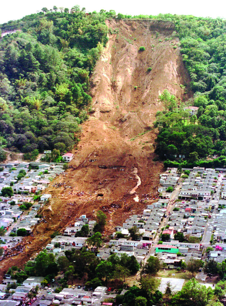
Image Courtesy: Wikimedia Commons
Technology, however, is only an enabler. Its true value lies in helping societies make wiser decisions and empowering people to act before hazards become disasters.
As India advances towards the vision of Viksit Bharat 2047, disaster resilience must become an integral part of development. Every road, bridge, hospital, school and industrial corridor should be planned with future risks in mind. Investments in science, innovation, resilient infrastructure and public awareness are investments in sustainable development and national security.
Natural hazards are inevitable, but disasters need not become human tragedies. By combining scientific excellence, technological innovation, effective governance and informed communities, India is building a future where resilience becomes a way of life.
The greatest achievement of science is not that it helps us understand nature—it is that it enables us to protect lives, safeguard development and build a safer, stronger and more resilient India for generations to come.
*The writer is Member, National Disaster Management Authority, Government of India.